Saint Vrain Wildfire/Watershed Assessment
Project Summary
Completion Date: 2012
Partners
US Forest Service
JWA completed a wildfire/watershed assessment and prioritization for the Saint Vrain Watershed. The Saint Vrain Watershed includes the St. Vrain, Boulder, Lefthand and Coal Creeks. The assessment followed a procedure prescribed by the Watershed Wildfire Protection Group titled “Protecting Critical Watersheds in Colorado from Wildfire: A Technical Approach to Watershed Assessment and Prioritization”.
The report and related documents can be found below in the Documents section. A slide show of the maps from the report can be viewed below in the Maps section. The basic analysis for the Saint Vrain Watershed was completed as part of the Bark Beetle Incident Watershed work.
Project Actions
Identification & prioritization of critical watersheds
Recommendation of measures to protect the identified watersheds
Technical review of watershed health/hazards
Facilitate stakeholder meetings and investment in order to communicate the suggested process, listen to any suggested changes, and build collaborative support for the assessment process
Benefits
Protect critical water supplies and natural resources
Mitigate adverse effects of post-wildfire hydrologic changes, including:
Flooding
Erosion
Deposition
Introduction of potential contaminants
Provide technical assessments to support short- and long-term watershed planning & protection actions
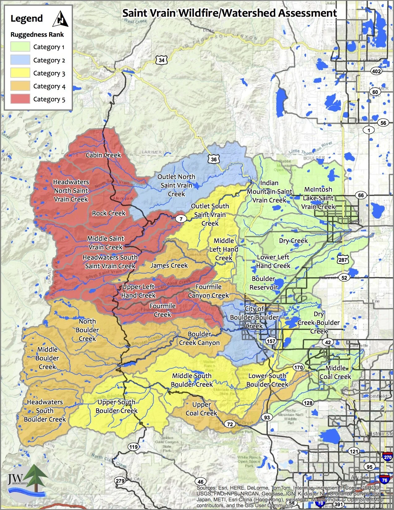
Maps
The maps in the slide show below are from the Saint Vrain Wildfire/Watershed Assessment. Click on the slide show to view the priority maps. The legend text identifies the ranking item. Descriptions of the maps and how they were created are contained in the report located in the Documents section.