Spring Creek Fire - Costilla County Watershed Protection & Treatment Prioritization
Project Summary
Completion Date:
Partners
The Spring Creek Fire of 2018 burned over 108,000 acres including some important watersheds in the headwaters of Sangre de Cristo Creek, Wagon Creek and West Indian Creek in Costilla County, Colorado. The Spring Creek Fire also burned across the divide to the east in Huerfano County. More than 4,000 acres of high burn severity have been identified in Costilla County.
The watershed assessments technical components follow a number of watershed/wildfire hazard assessments that JW Associates has completed in Colorado both pre- and post-fire. The components followed a procedure prescribed by Watershed Wildfire Protection Group, formerly known as the Front Range Watershed Protection Data Refinement Work Group (2009). The Spring Creek Fire Burned Area Emergency Response (BAER) Report (USDA Forest Service et al. 2018) also provided some analysis.
The report and related documents can be found below in the Documents section. A slide show of the maps from the report can be viewed below in the Maps section.
Project Actions
Identification & prioritization of zones of concern
Identify potential hazards to water supply in zones of concern
Ranking of watersheds based on their hazards
Determine priorities for post-fire watershed treatments
Identify potential treatment areas within the priority watersheds
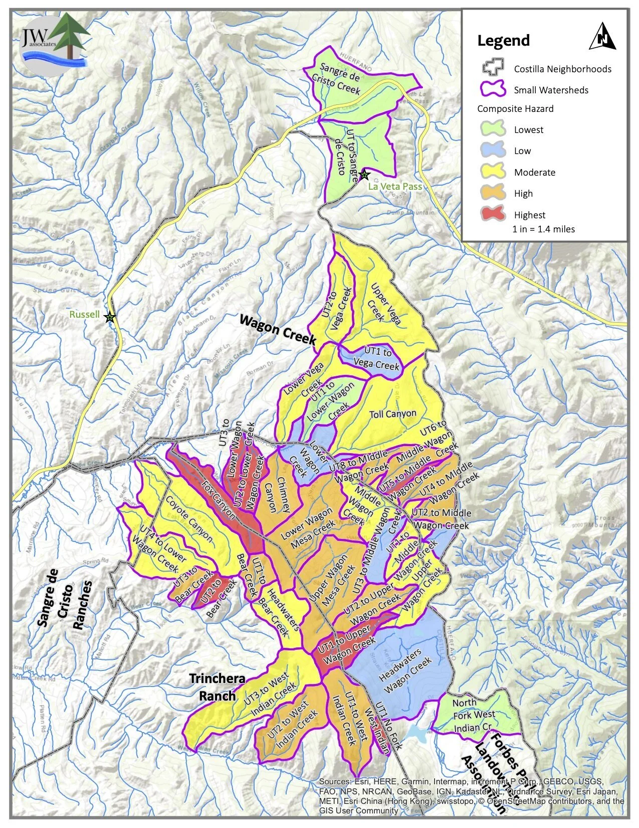
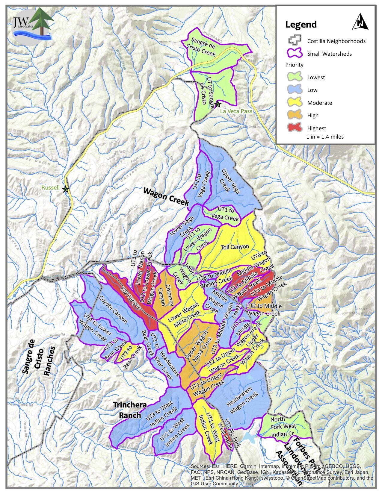
Map small-scale watersheds (seventh-level) for the purpose of this project
Fire-nado area pictured above
Benefits
Protect critical water supplies and natural resources from adverse effects of post-wildfire hydrologic changes, including:
Flooding
Erosion
Debris flows
Deposition
Mitigate negative effects of wildfire through targeted projects
Maps
The maps in the slide show below are from the Spring Creek Fire - Costilla County Watershed Protection & Treatment Prioritization. Click on the slide show to view the priority maps. The legend text identifies the ranking item. Descriptions of the maps and how they were created are contained in the report located in the Documents section.