Upper Gunnison Wildfire / Watershed Hazard Assessment
Project Summary
Timeline: 2022 - 2023
Partners
Upper Gunnison River Watershed Conservancy District
Numerous agencies and organizations in the Upper Gunnison River watersheds
This assessment identifies hazards, prioritizes watersheds, and recommends measures to protect those watersheds that provide or convey critical community water supplies from the adverse effects of post-wildfire hydrologic changes, including flooding, erosion, debris flows, and deposition. The analysis also includes the effects of climate change on watershed health and function. The analysis was completed at the 6th level watershed scale.
The assessment followed a procedure prescribed by the Watershed Wildfire Protection Group titled “Protecting Critical Watersheds in Colorado from Wildfire: A Technical Approach to Watershed Assessment and Prioritization”.
Project Actions
Identify high hazard watersheds that may be severely impacted by future wildfires
Identify critical watersheds that provide community water supplies
Analyze opportunities and constraints to identify next steps for watershed protection
Benefits
Protect critical water supplies
Support ecosystem resiliency
Identify and minimize post-wildfire hazards
Recommendations for wildfire hazard mitigation and treatment opportunities
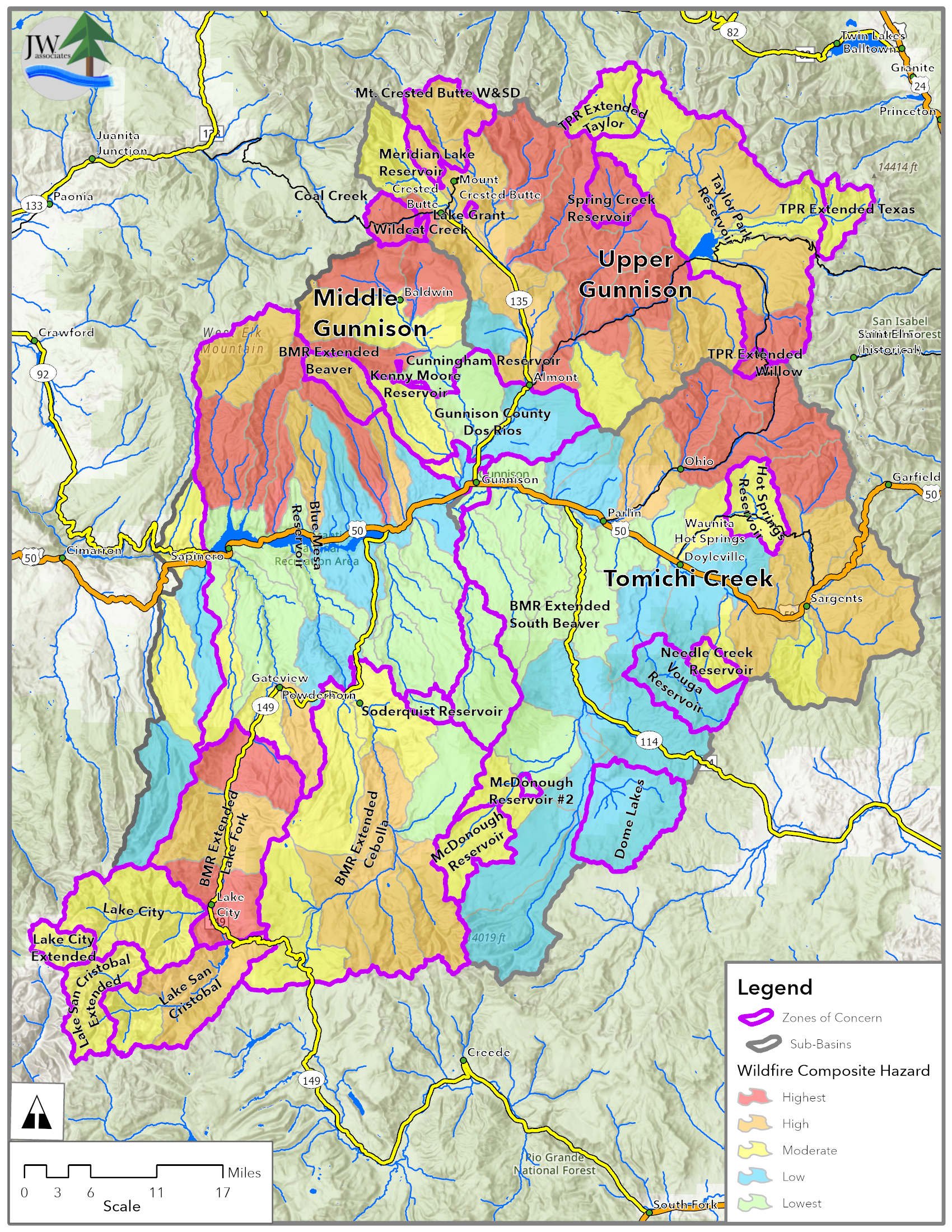
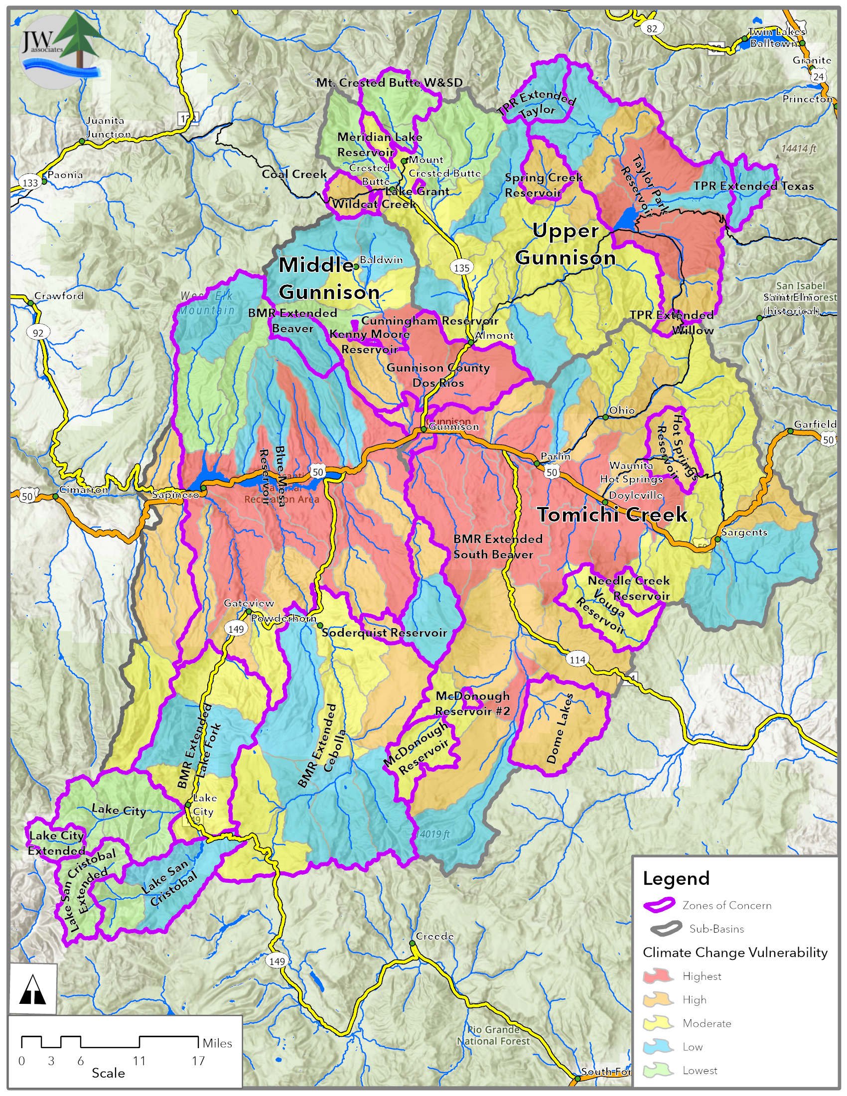
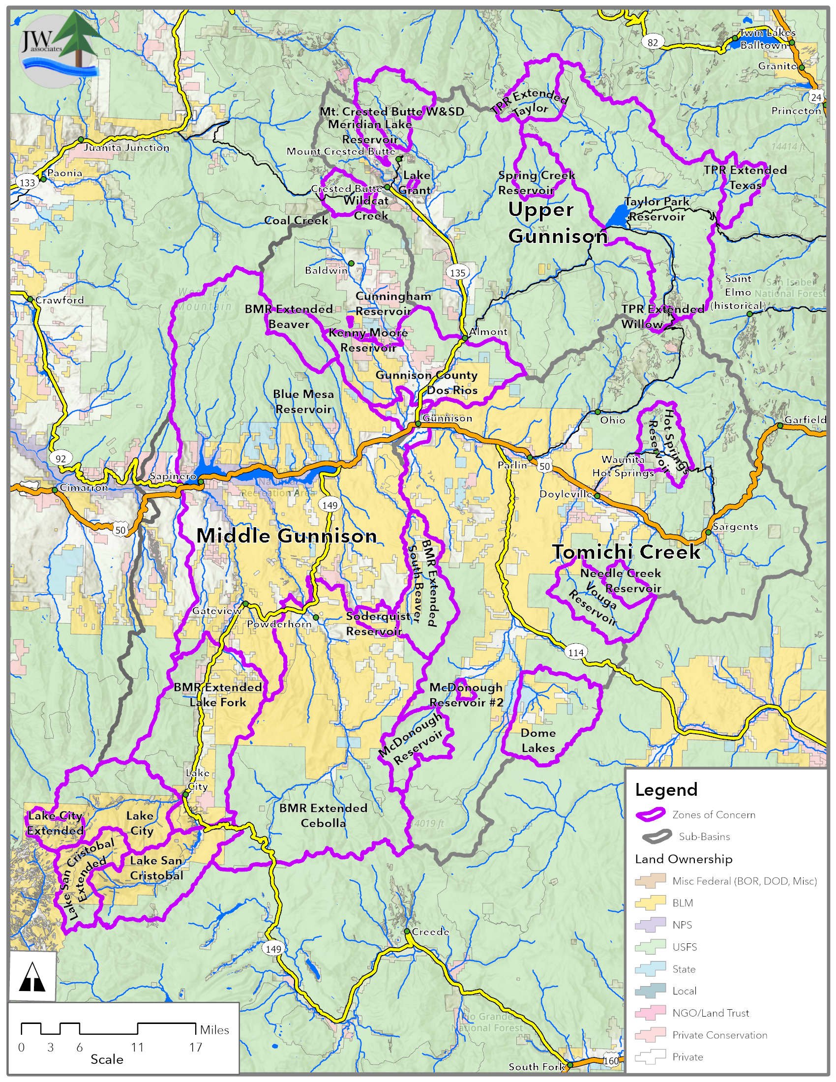
Maps
The maps in the slide show below are from the Upper Gunnison Wildfire/Watershed Hazard Assessment. Click on the slide show to view the priority maps. The legend text identifies the ranking item. Descriptions of the maps and how they were created are contained in the report located in the Documents section.
JW Associates created an interactive experience map for the Upper Gunnison Wateshed Wildfire Assessment, this map can be found at the link below.