Pikes Peak Wildfire/Watershed Assessment
Project Summary
Completion Date: 2012
Partners
Colorado Springs Utilities
Matrix Design Group
The Pikes Peak Watershed/Wildfire Assessment followed a procedure prescribed by the Watershed Wildfire Protection Group titled “Protecting Critical Watersheds in Colorado from Wildfire: A Technical Approach to Watershed Assessment and Prioritization”.
The Pikes Peak Wildfire/Watershed Assessment identifies, prioritizes, and recommends measures to protect those watersheds that provide or convey critical community water supplies from the adverse effects of post-wildfire hydrologic changes, including flooding, erosion, debris flows, and deposition.
Project Actions
Identify & prioritize watersheds of concern
Recommend measures to protect critical water supplies in the watersheds of concern
Complete an opportunities and constraints analysis to identify potential next steps for watershed protection
Benefits
Protect critical water supplies and natural resources
Mitigate negative effects of wildfire through targeted projects
Protect river ecosystem functions and health
Provide technical assessments to support short- and long-term watershed planning & protection actions
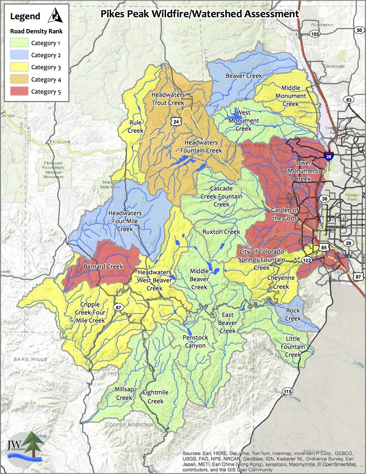
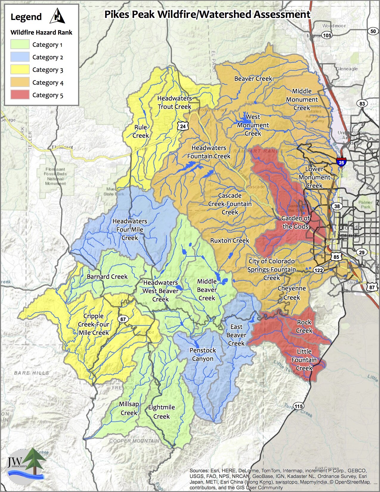
Maps
The maps in the slide show below are from the Pikes Peak Wildfire/Watershed Assessment. Click on the slide show to view the priority maps. The legend text identifies the ranking item. Descriptions of the maps and how they were created are contained in the report located in the Documents section.