Aurora Water Source Water Protection Plan
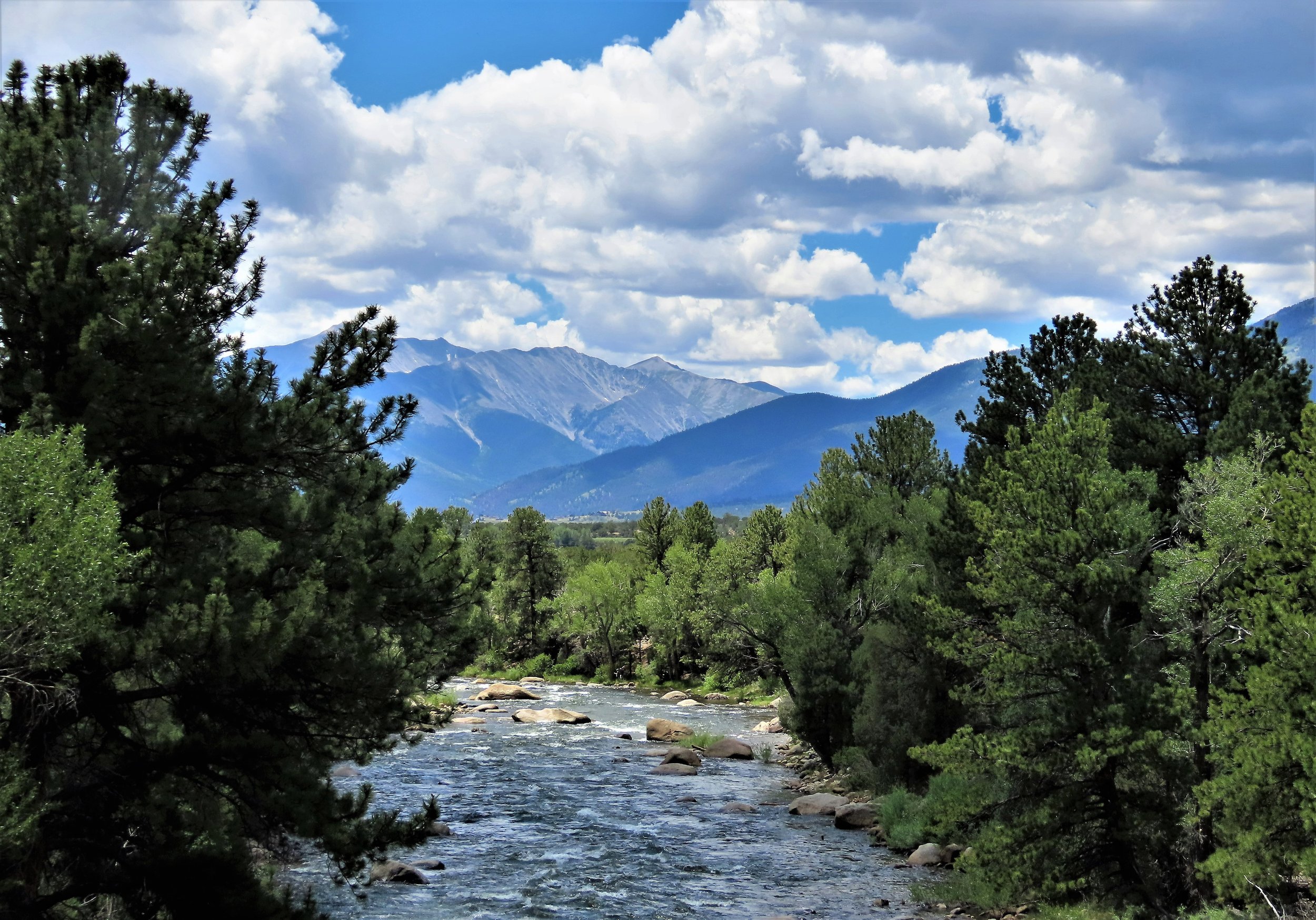
Photo: Patricia Henschen, Flickr
Project Summary
Completion Date: September 2022
Partners
City of Aurora
Stakeholders and affiliated agencies
JW Associates provided watershed assessment services and technical components for Aurora Water in support of their Watershed Management and Source Water Protection Plan. The plan has not been finalized or shared with the public.
Project Actions
Identification of remaining post-fire priorities/projects
Organizing and facilitating stakeholder meetings and communication
Technical analysis and prioritization of areas of concern
Field data collection and rapid assessment of high priority areas identified in technical analysis
Benefits
Protect critical water supplies and natural resources
Mitigate negative effects of wildfire through targeted projects
Protect river ecosystem functions and health
Provide technical assessments to support short- and long-term watershed planning & protection actions
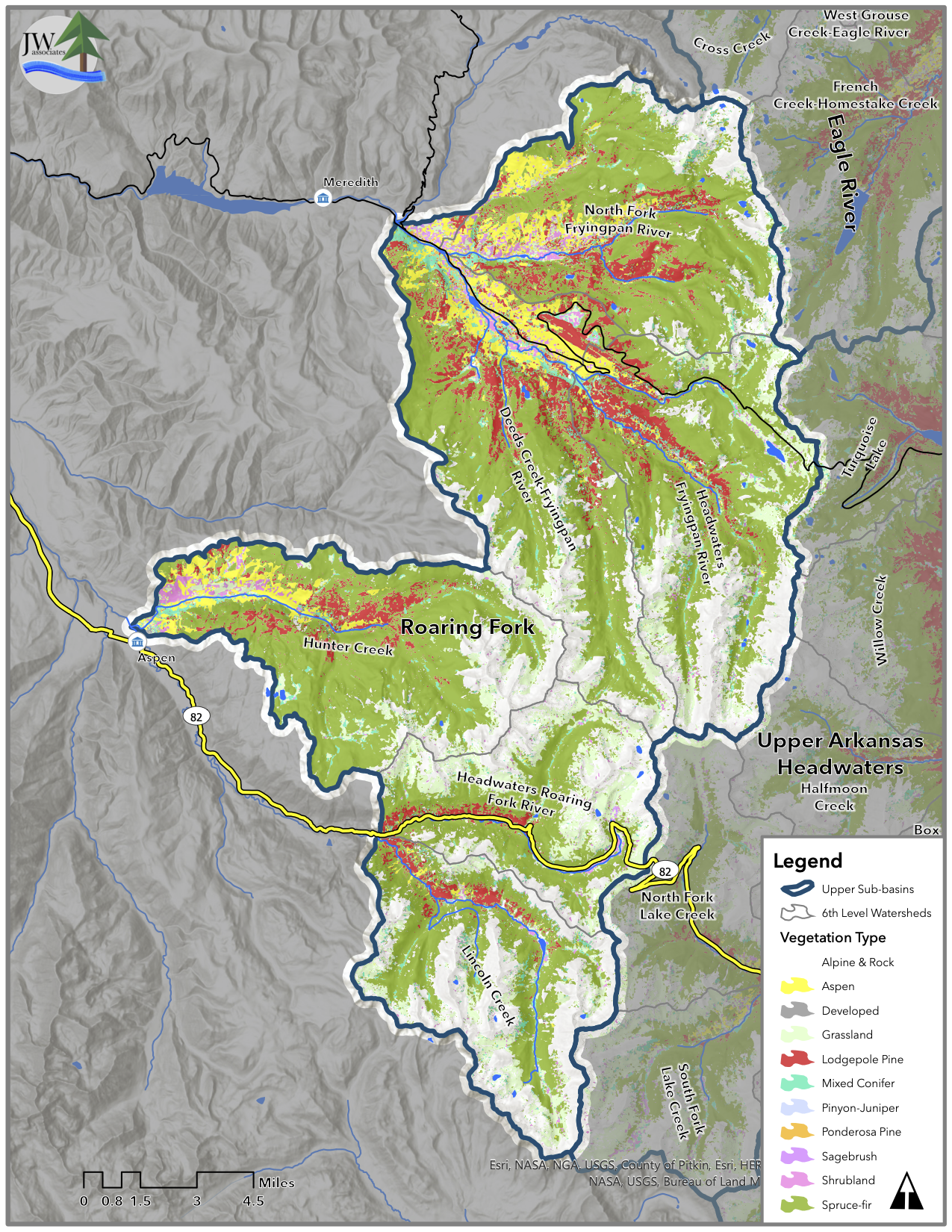
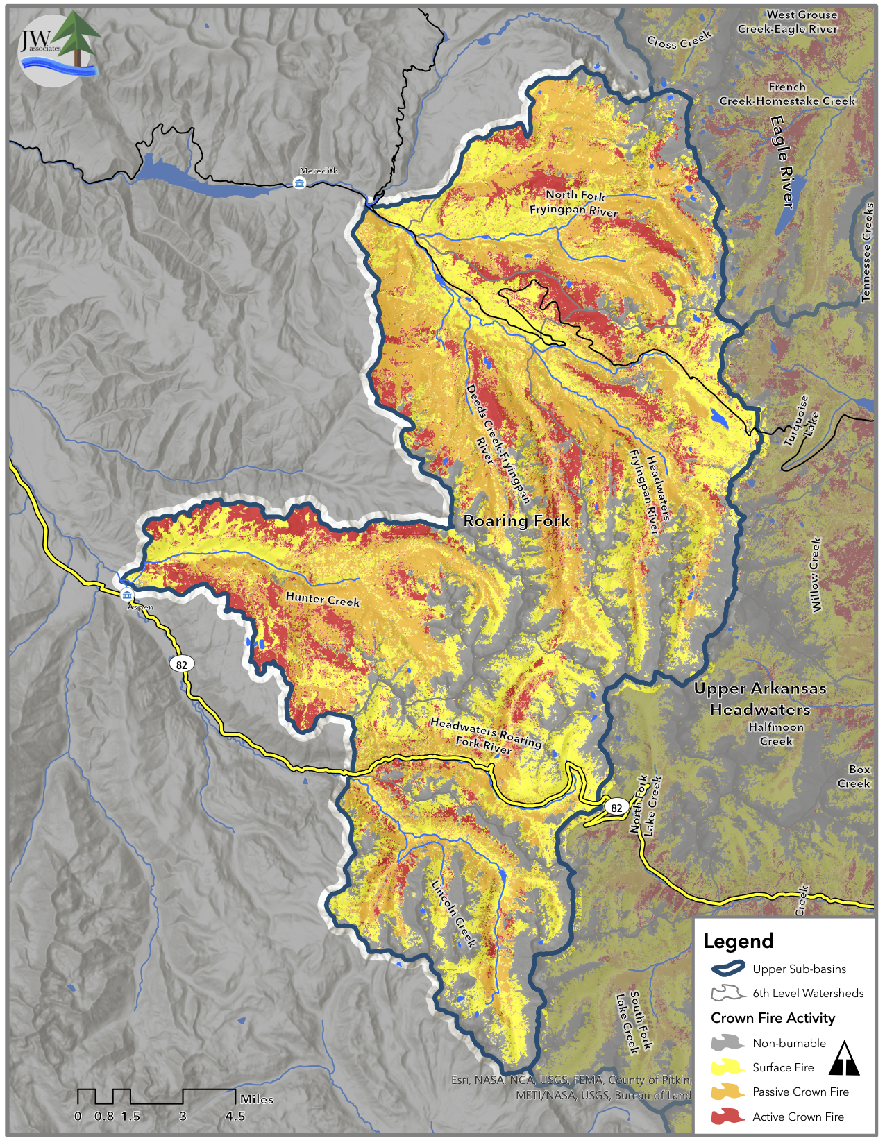
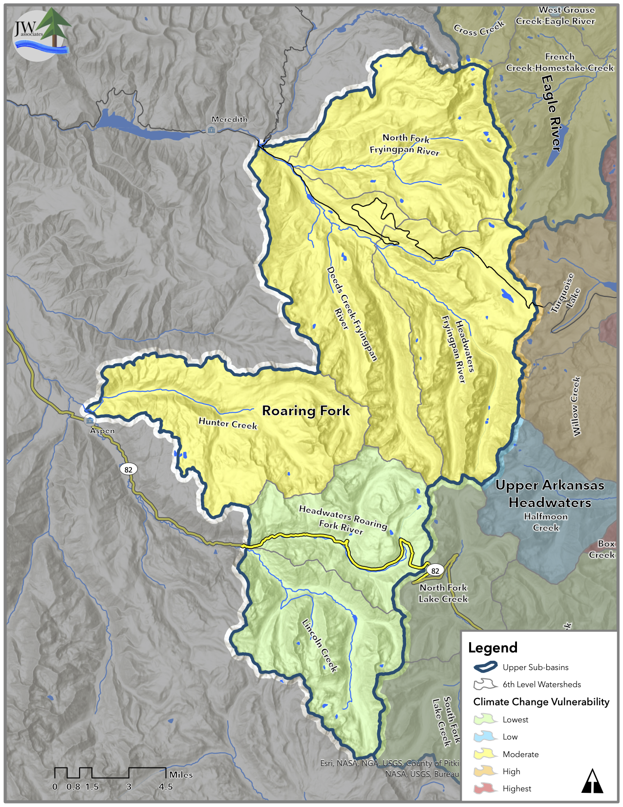
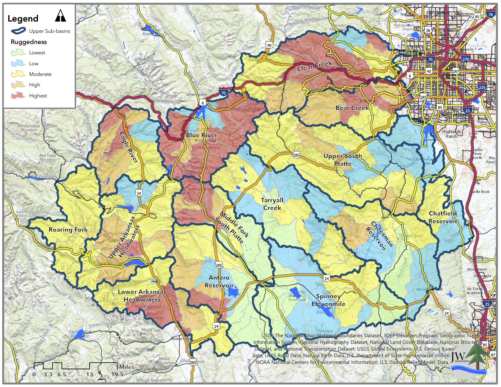
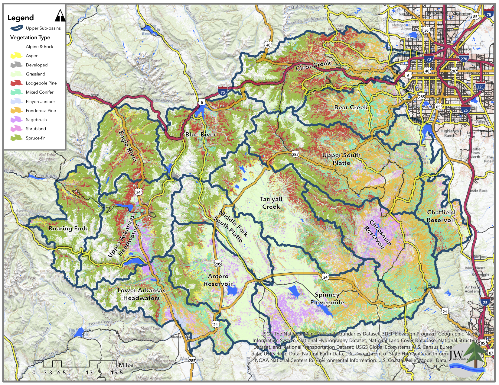
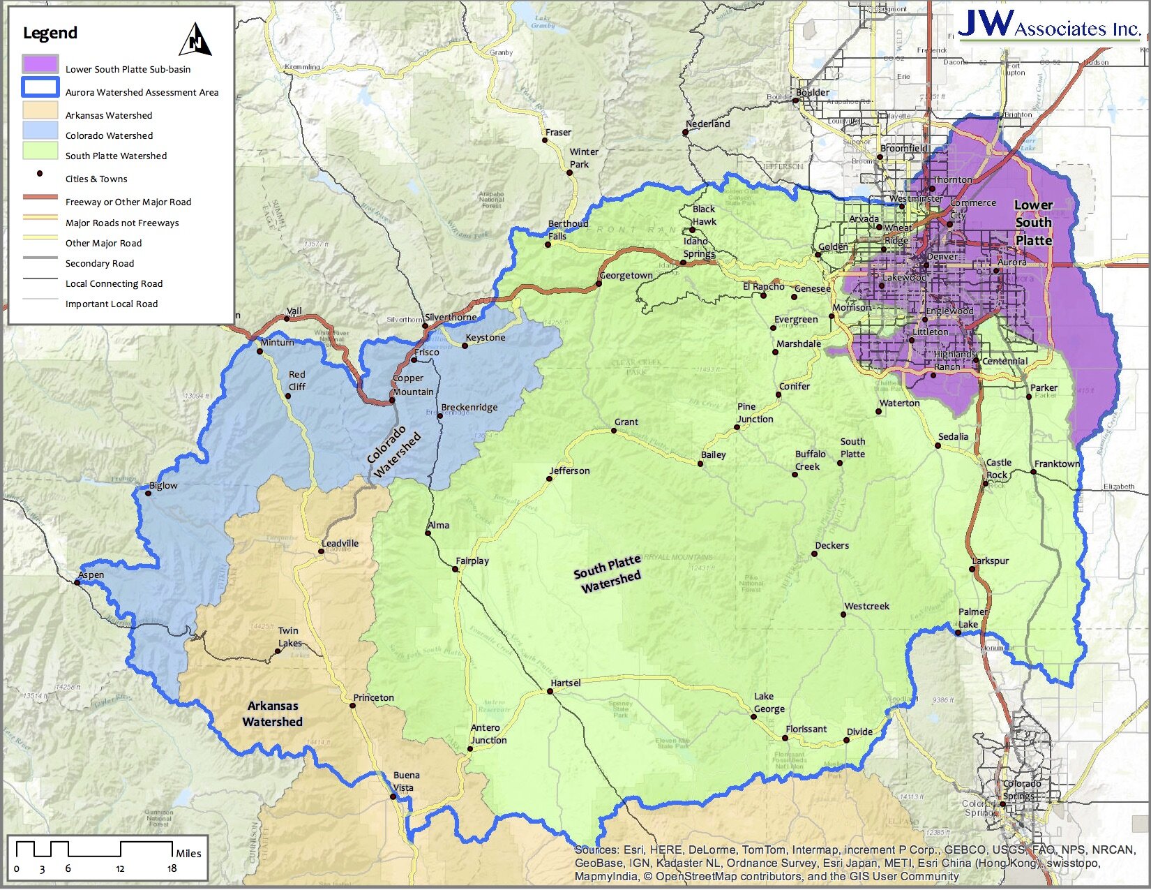
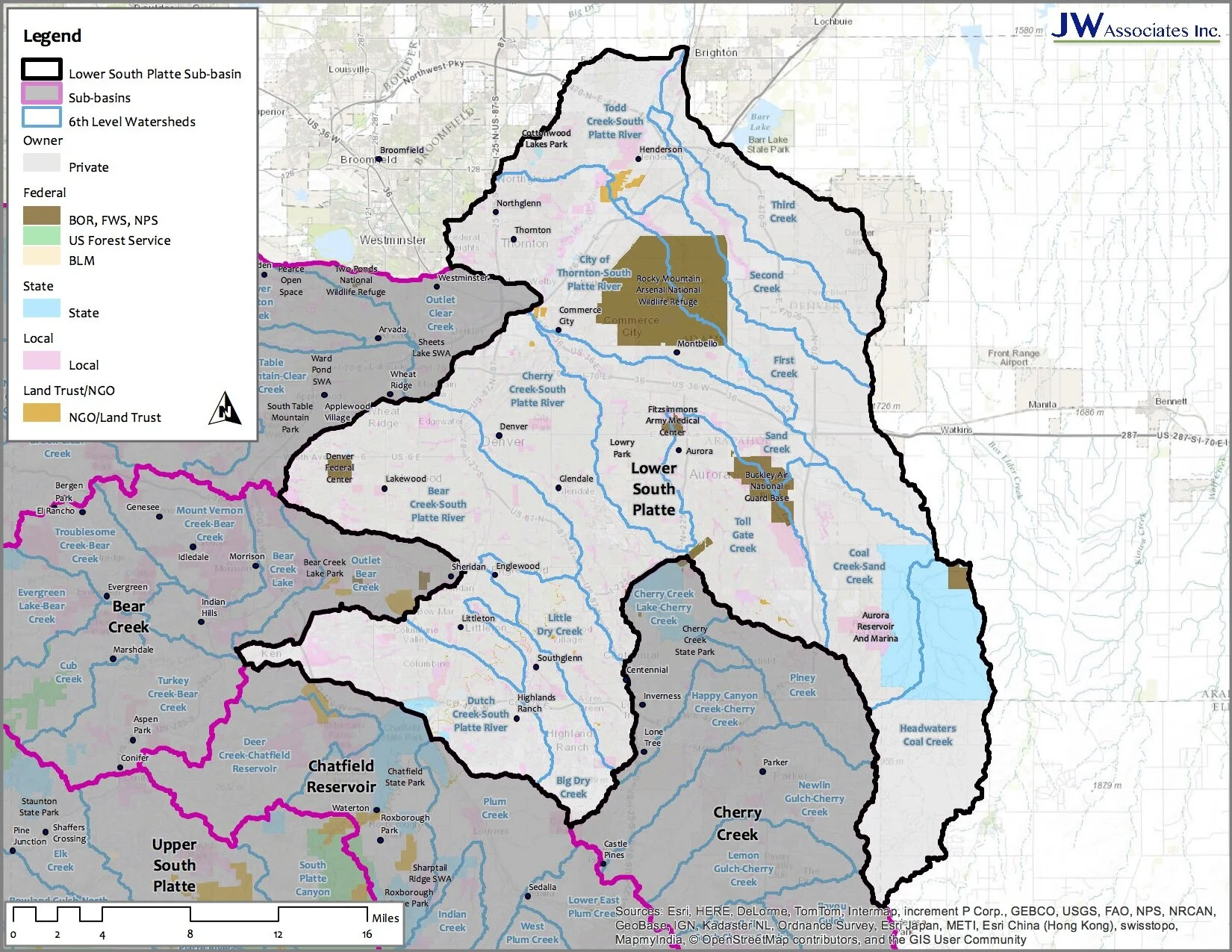
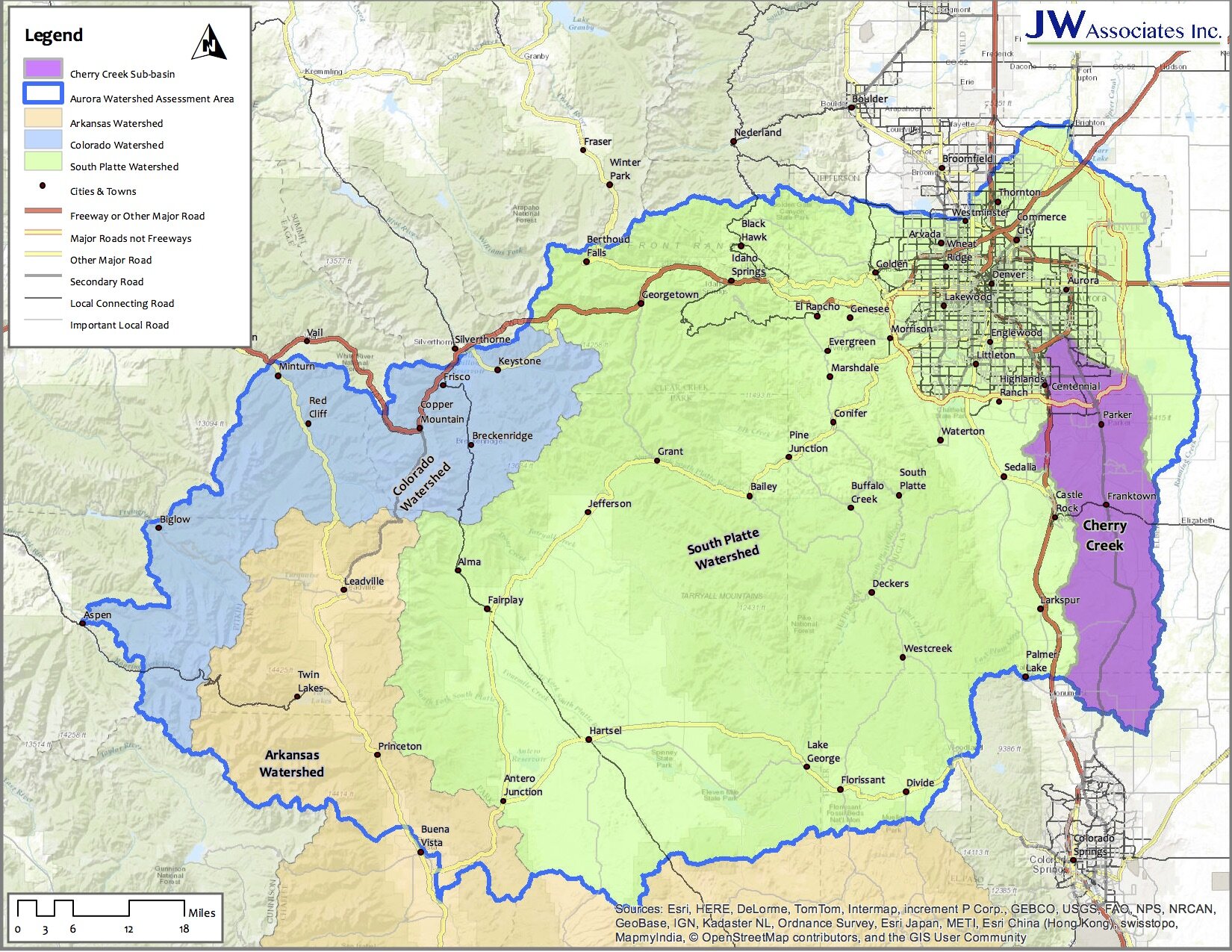
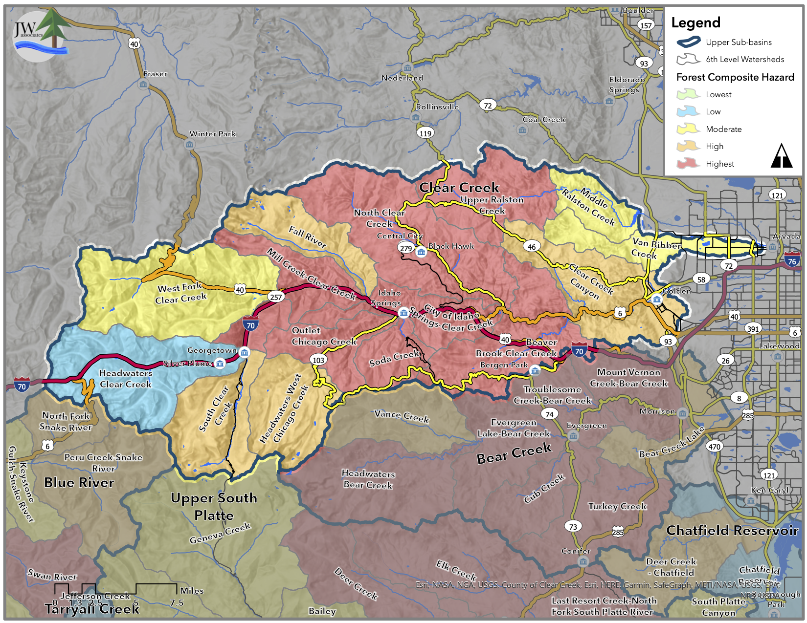
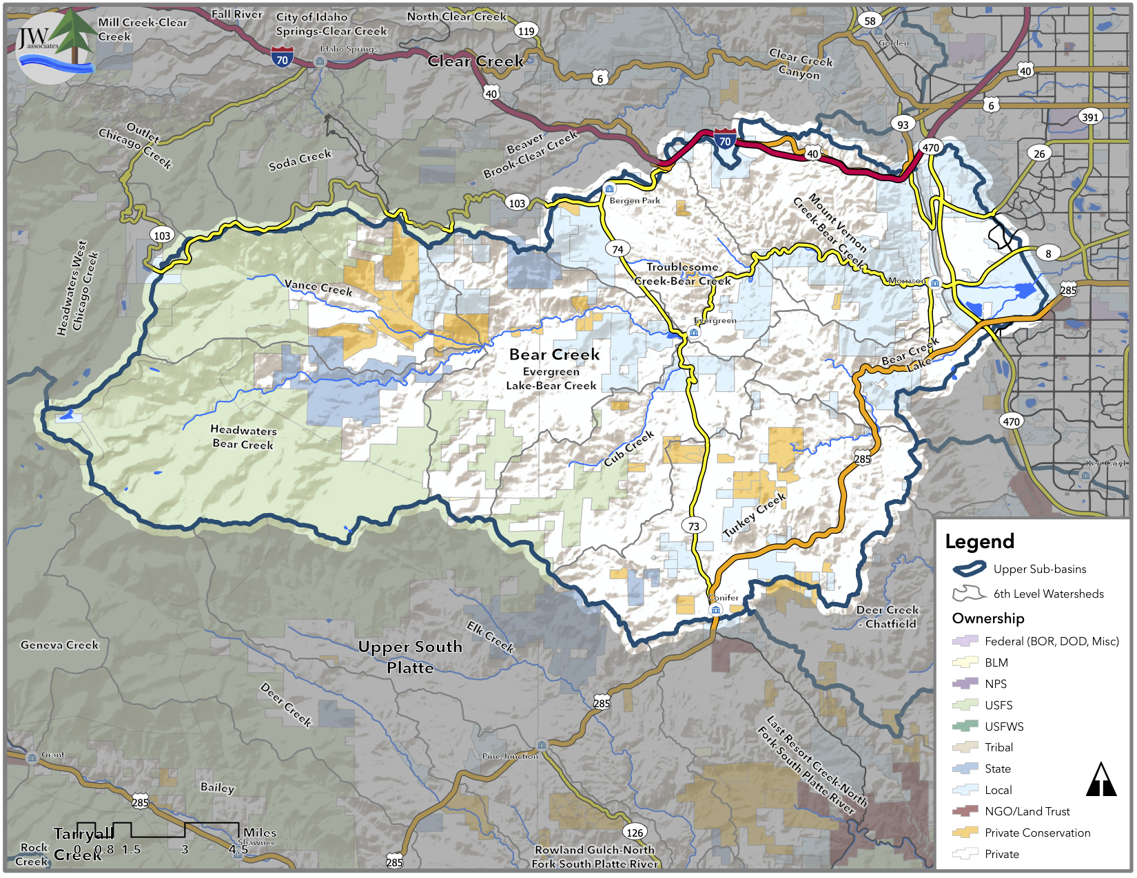
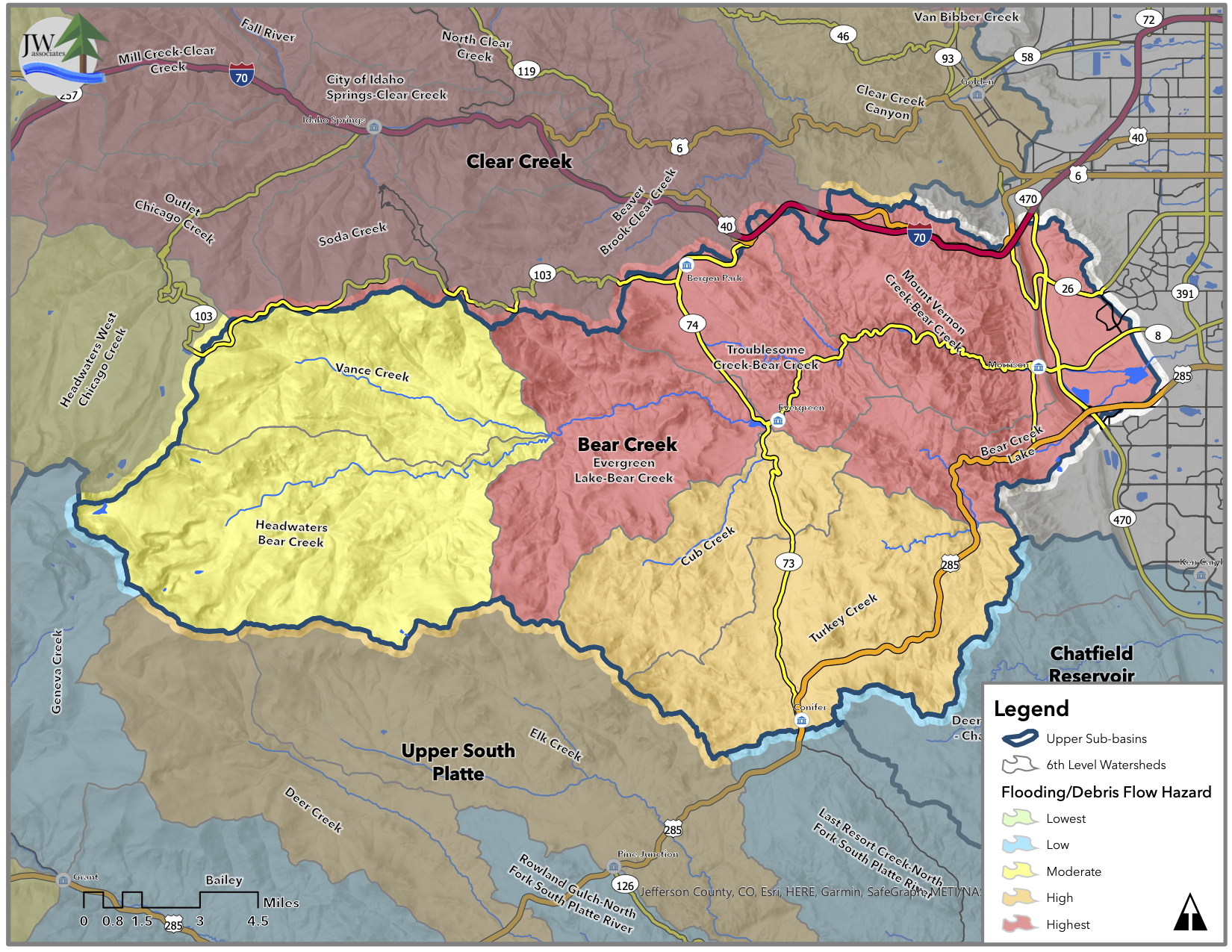
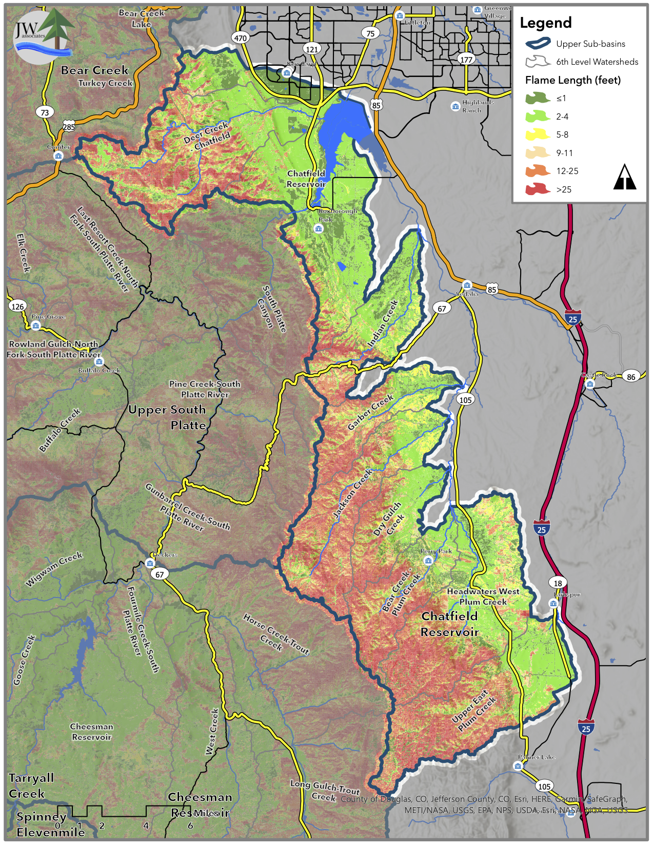
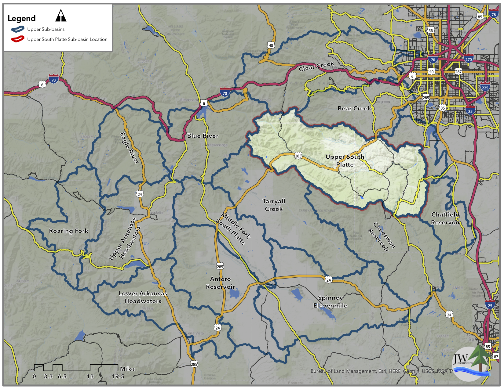
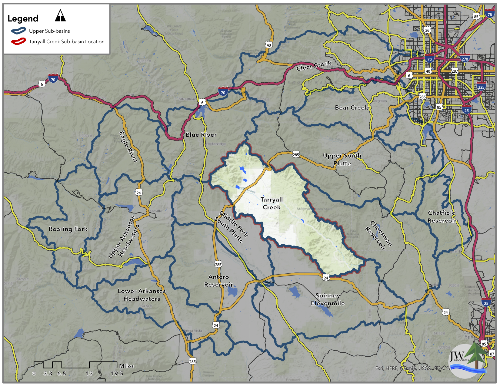
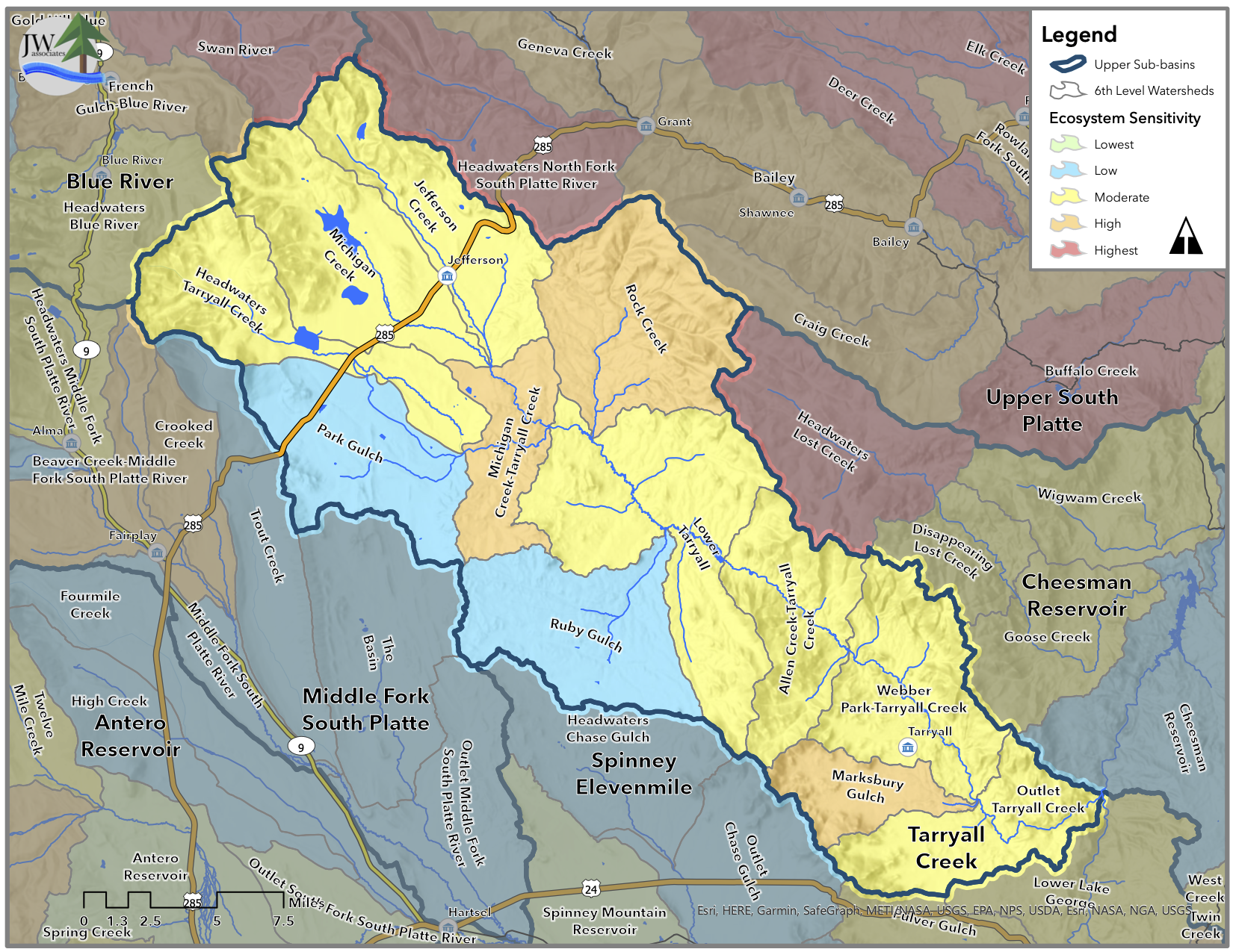
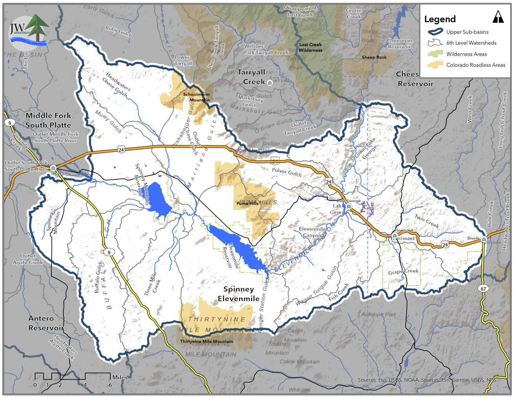
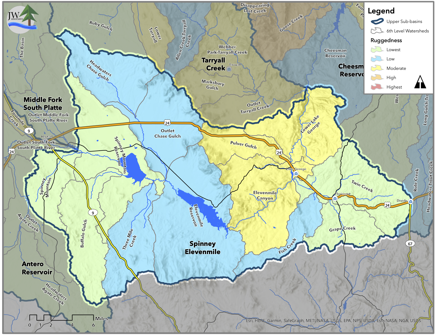
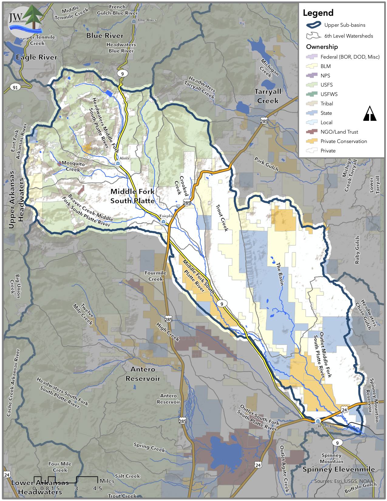
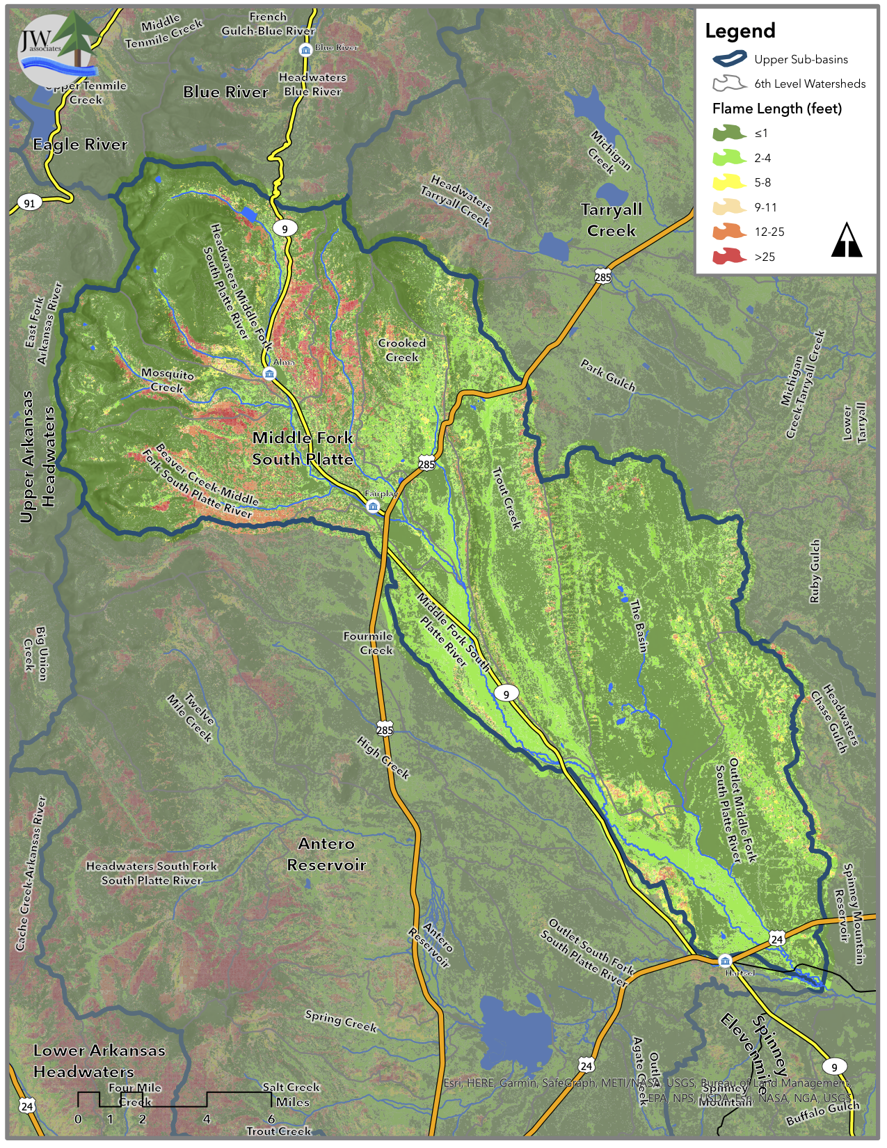
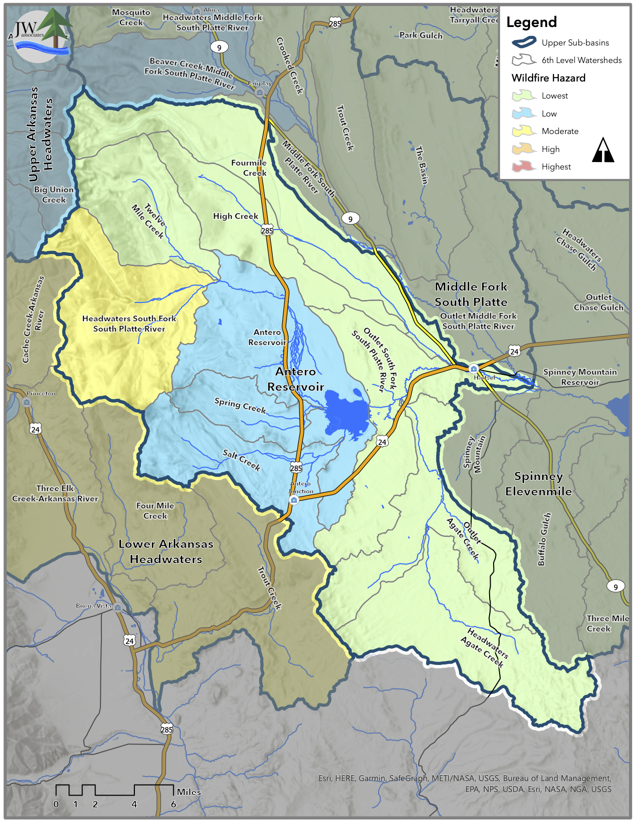
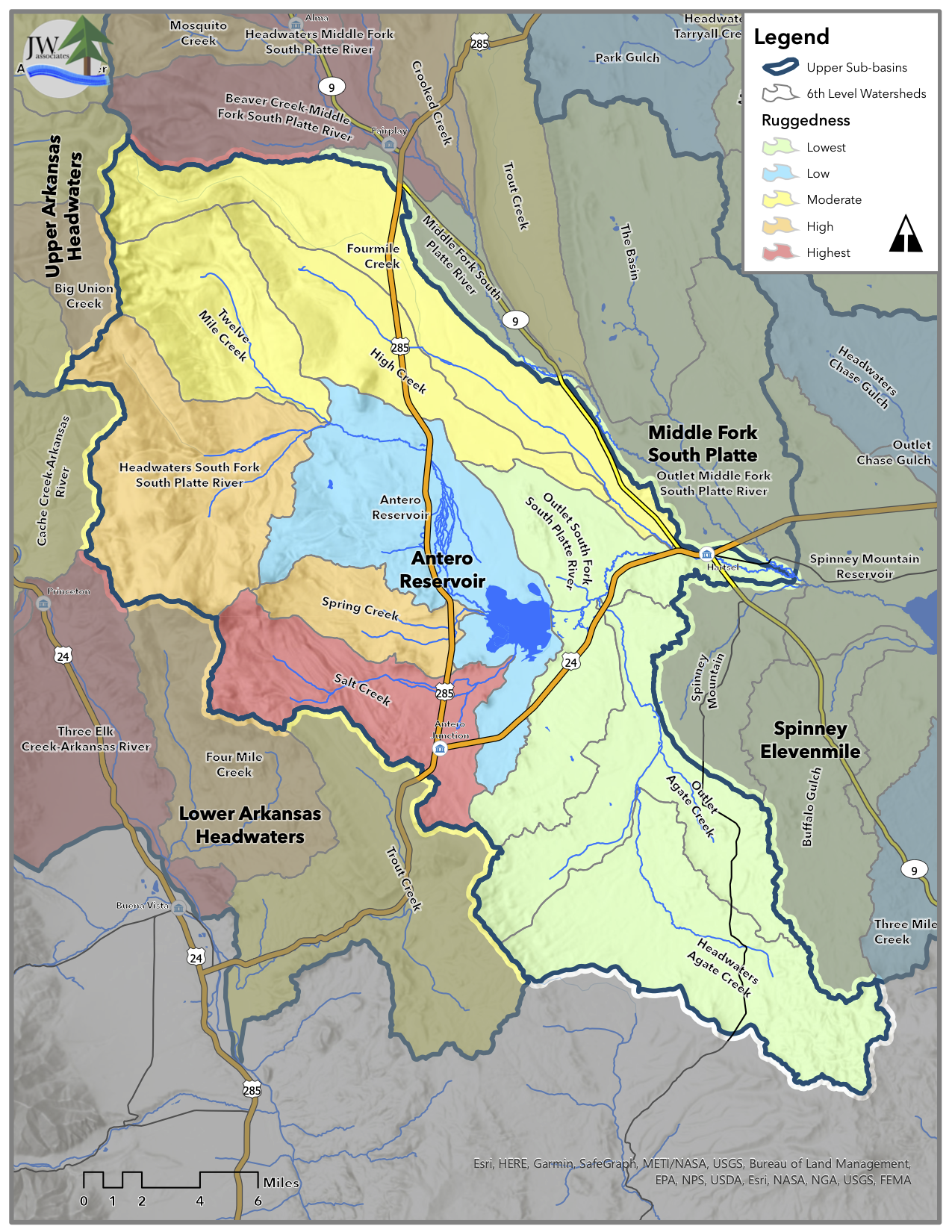
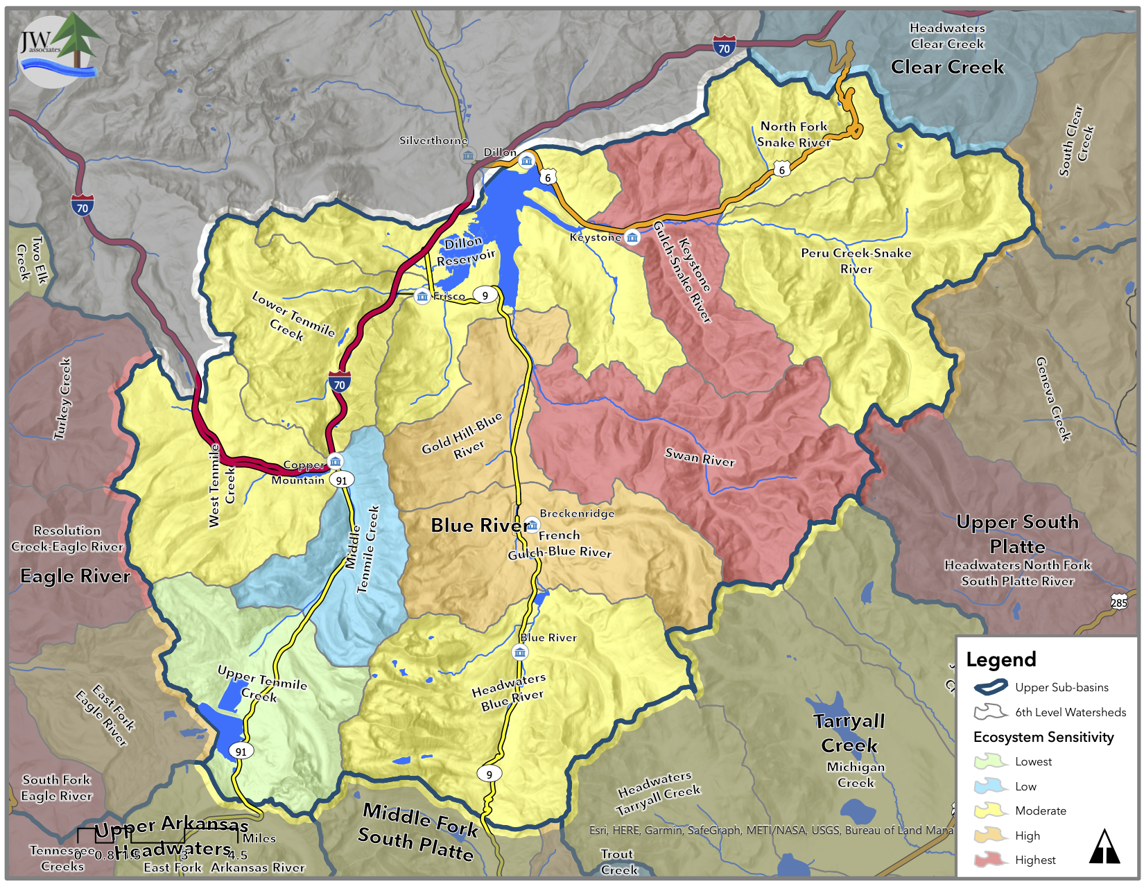
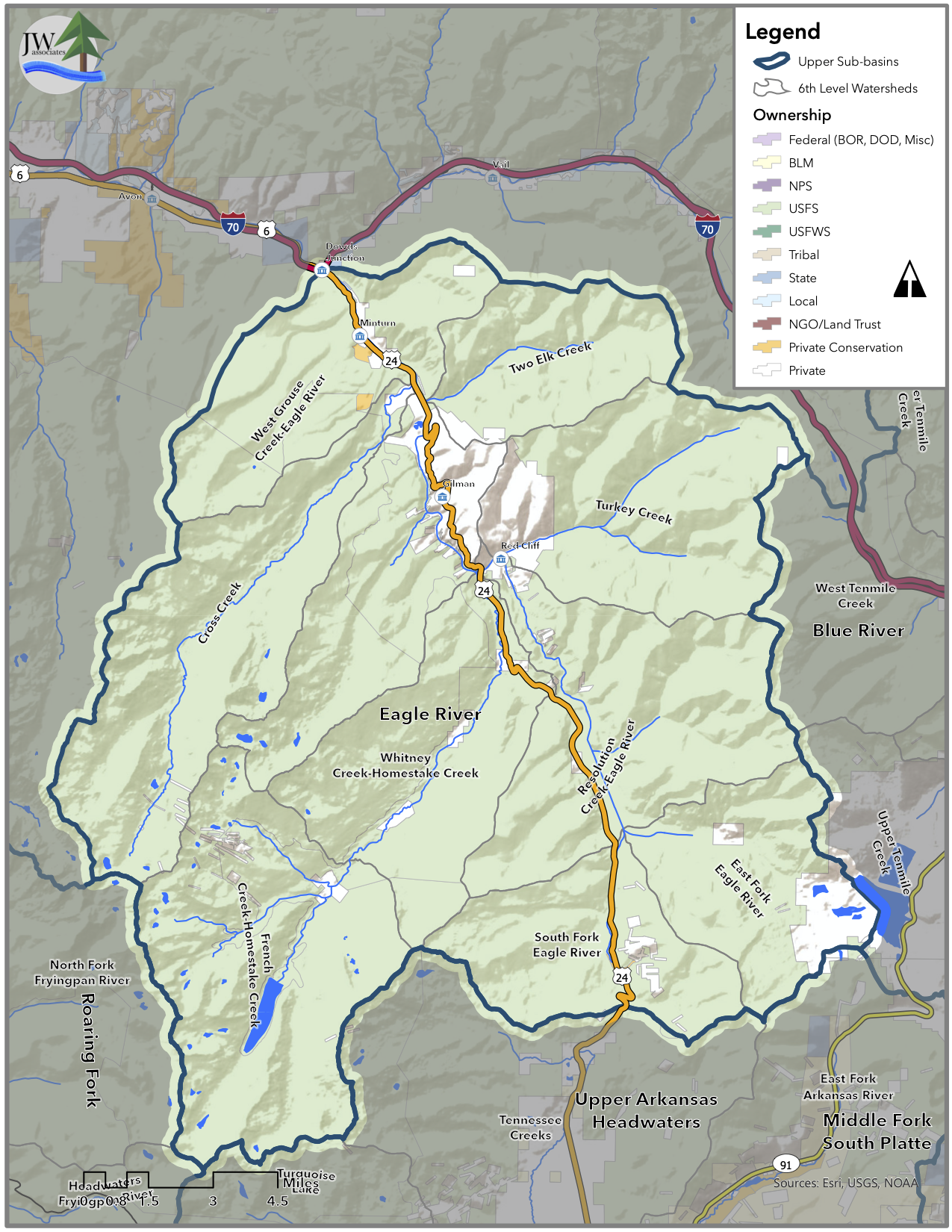
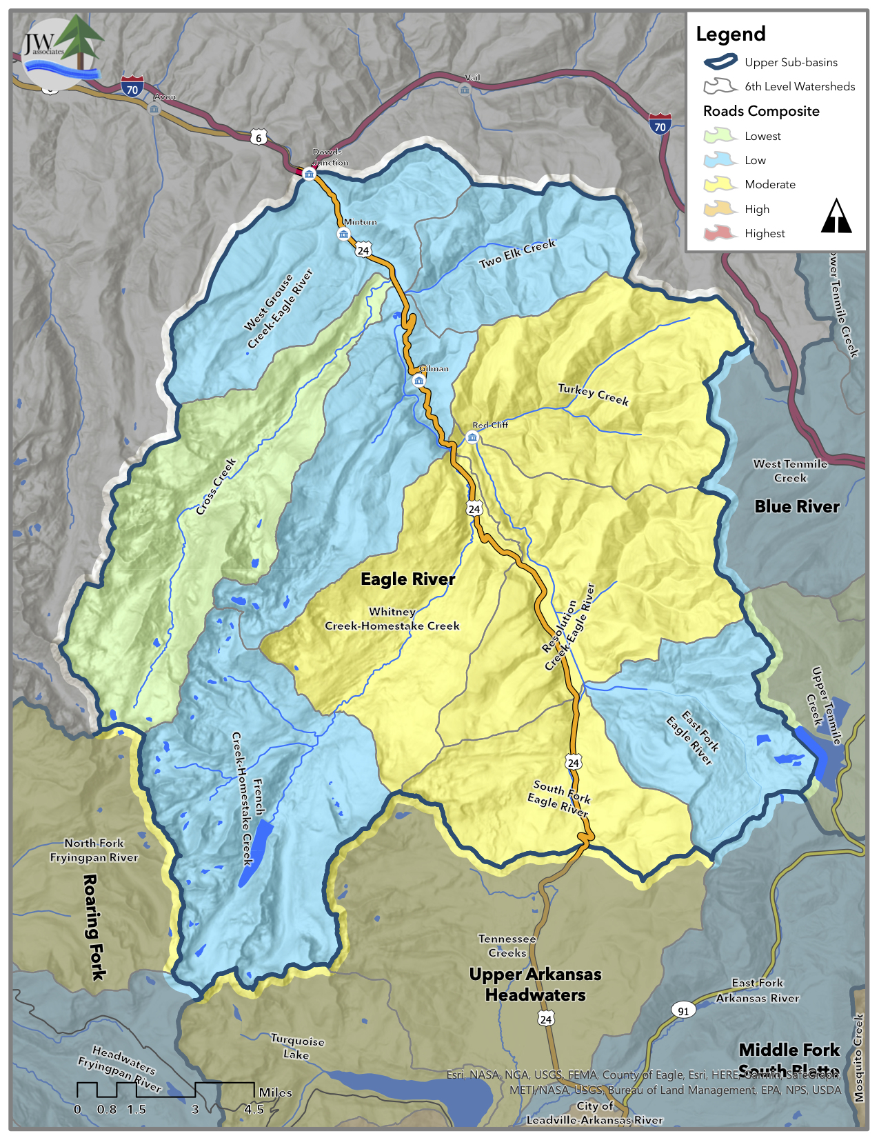
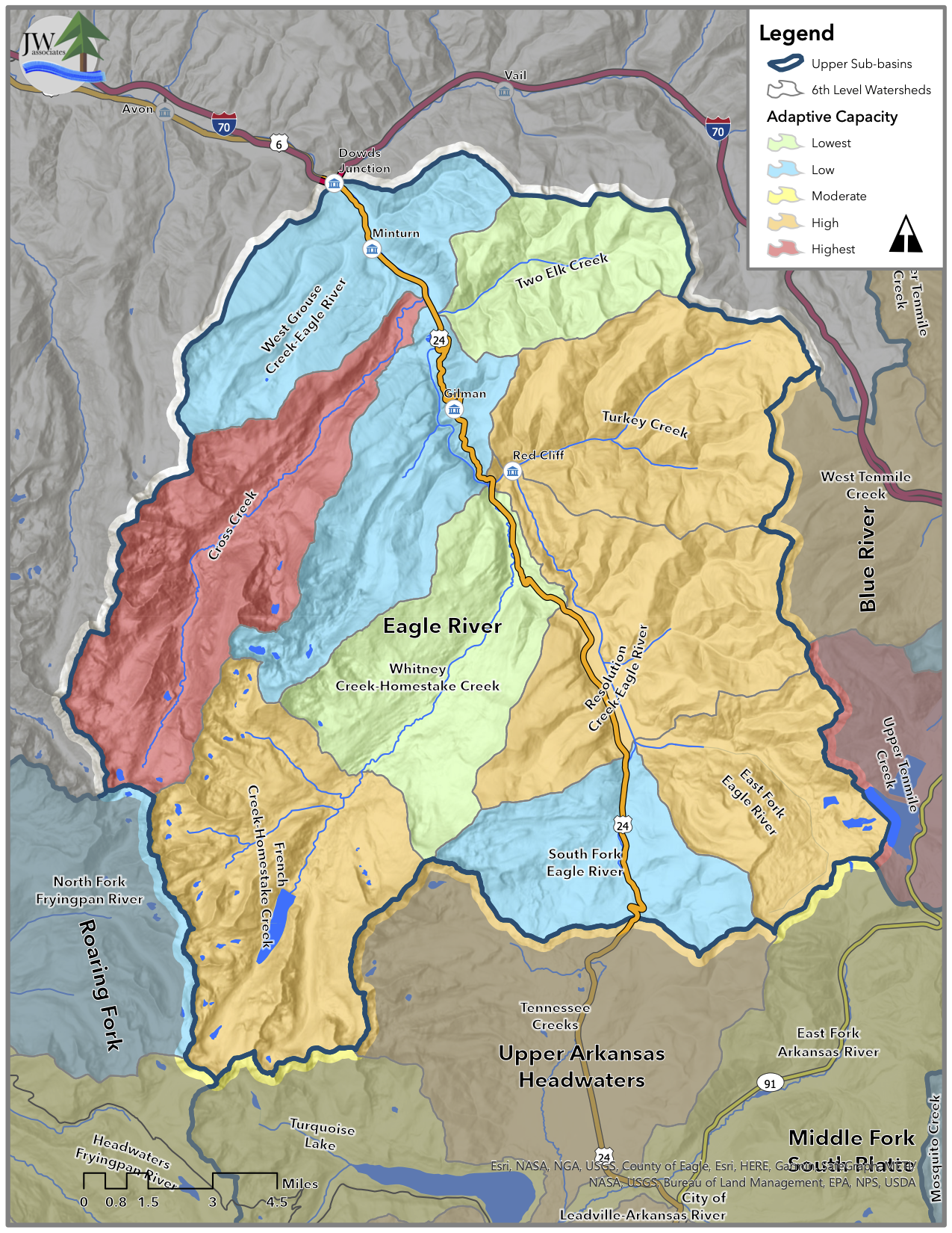
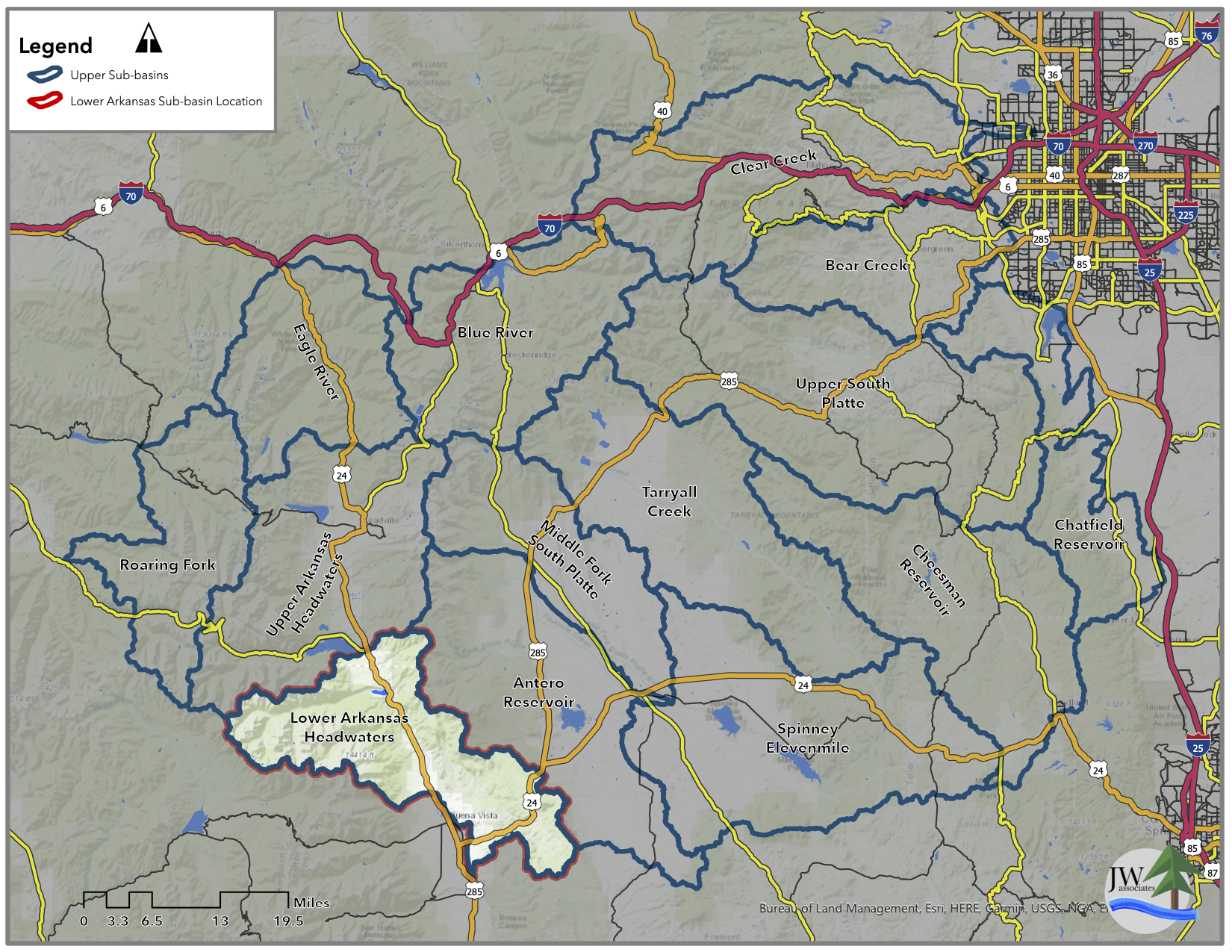
Watershed Assessment Areas

The large assessment was divided into the 16 Sub-basins identified in this map.
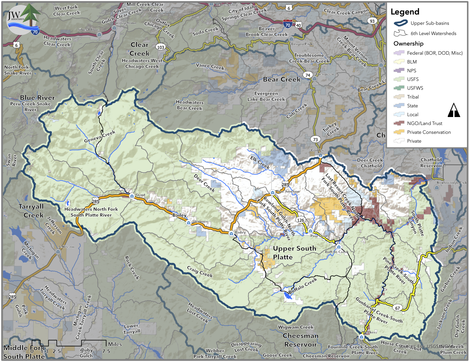
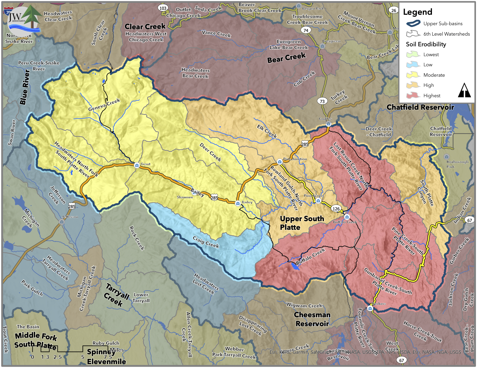
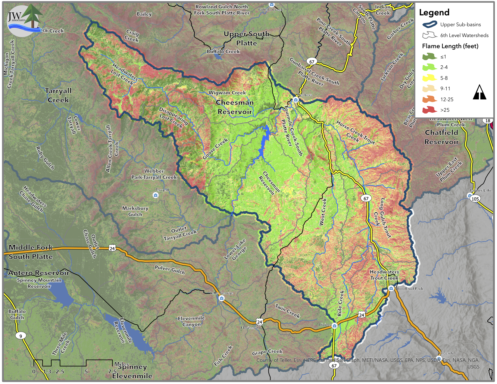
Project Maps
A slide show with maps of the key components of the watershed assessment portion of the plan are presented below for each sub-basin.
Aurora Watershed Overview


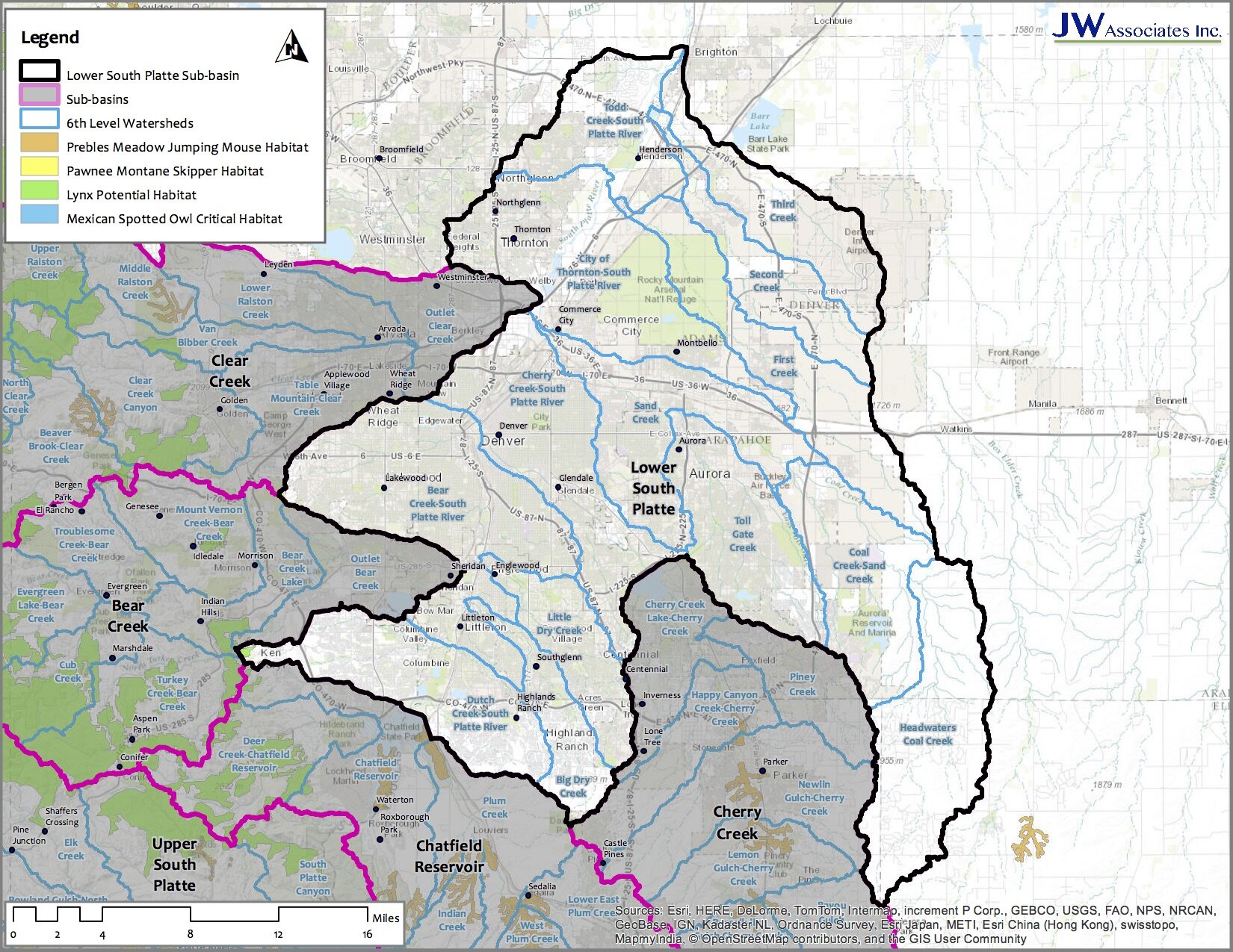
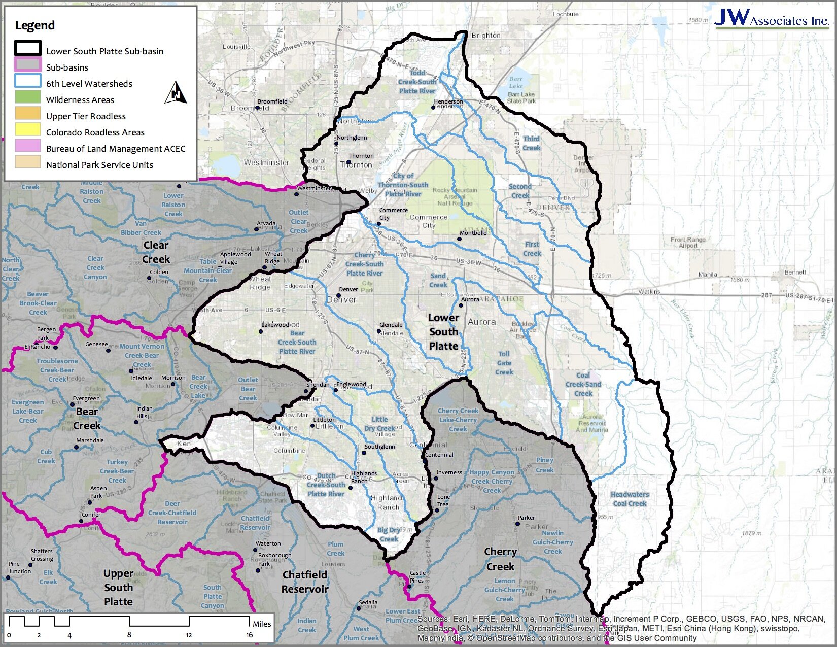
Lower South Platte Sub-Basin


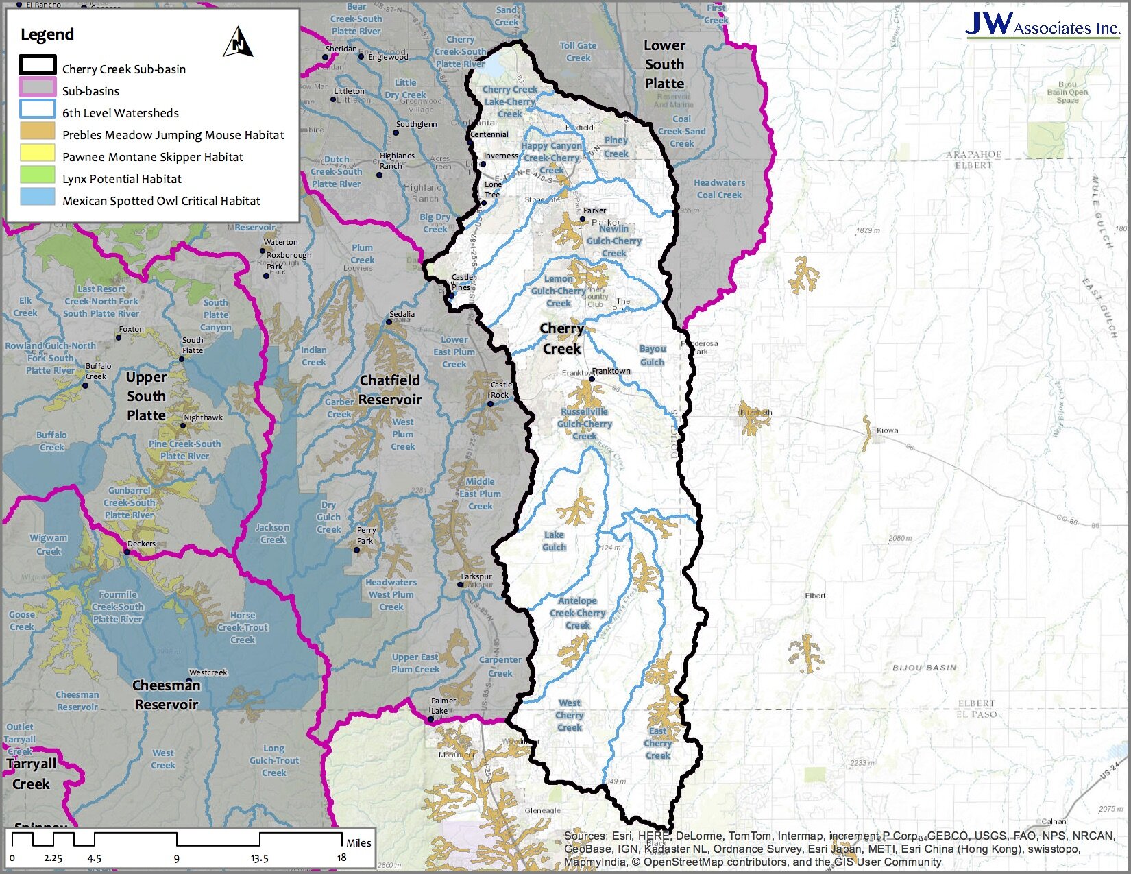
Cherry Creek Sub-Basin


Clear Creek Sub-Basin


Bear Creek Sub-Basin


Chatfield Reservoir Sub-Basin


Upper South Platte Sub-Basin


Cheesman Reservoir Sub-Basin


Tarryall Creek Sub-Basin


Spinney Elevenmile Sub-Basin


Middle Fork South Platte Sub-Basin


Antero Reservoir Sub-Basin


Blue River Sub-Basin


Eagle River Sub-Basin


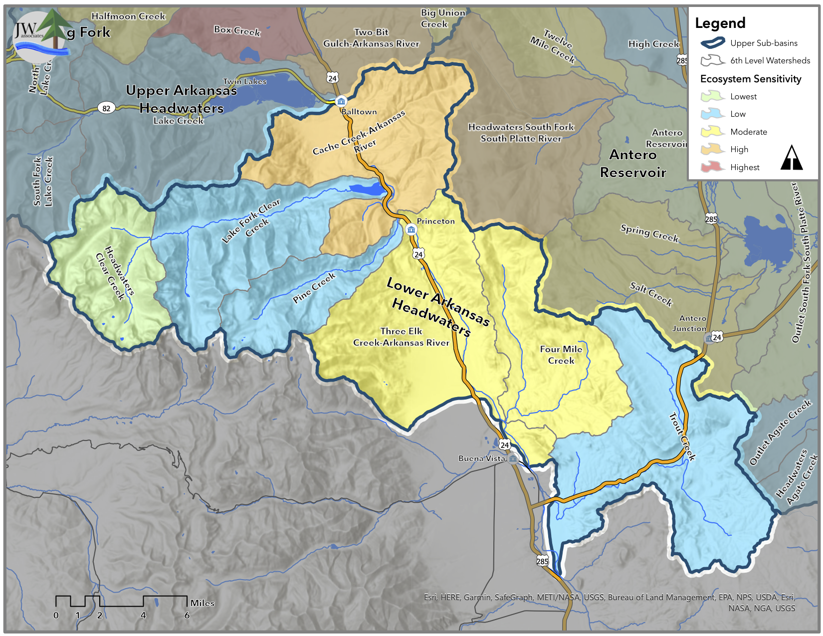
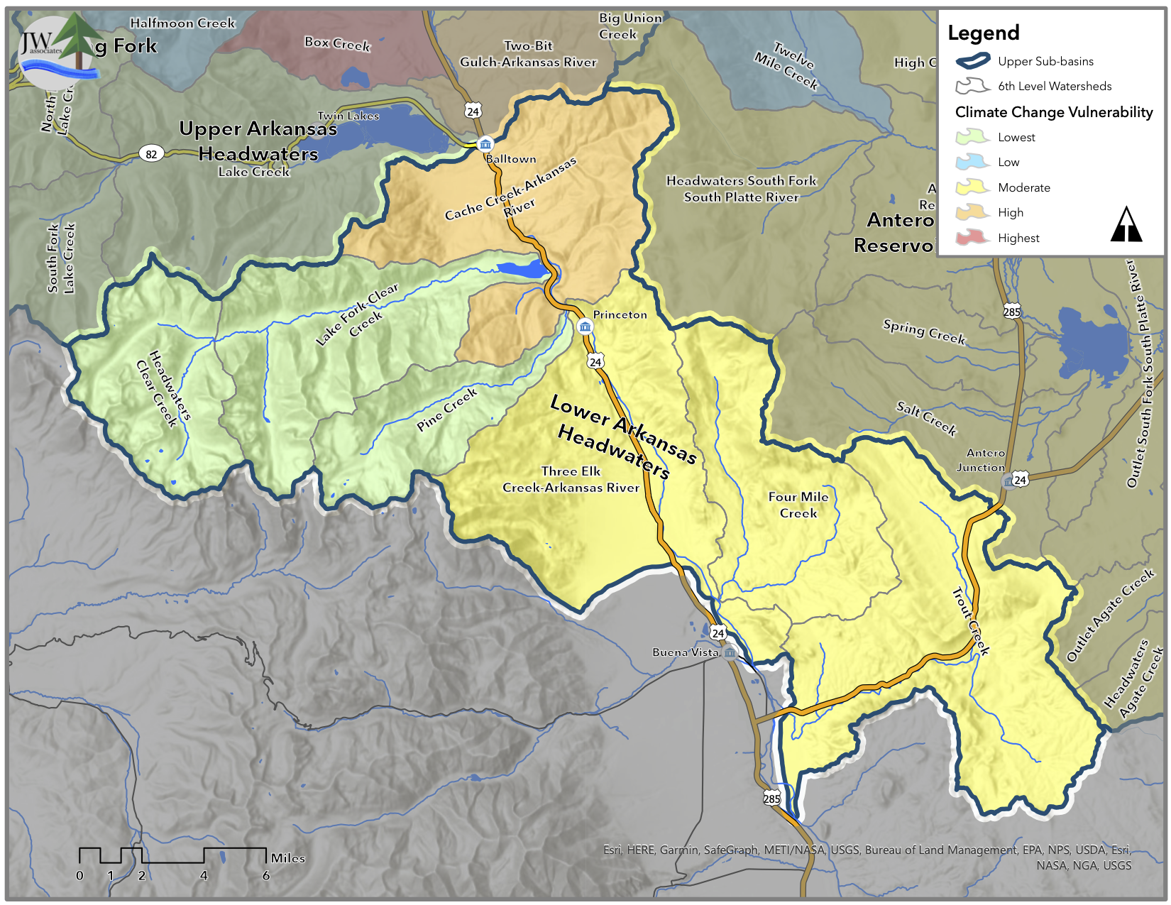
Lower Arkansas Headwaters Sub-Basin


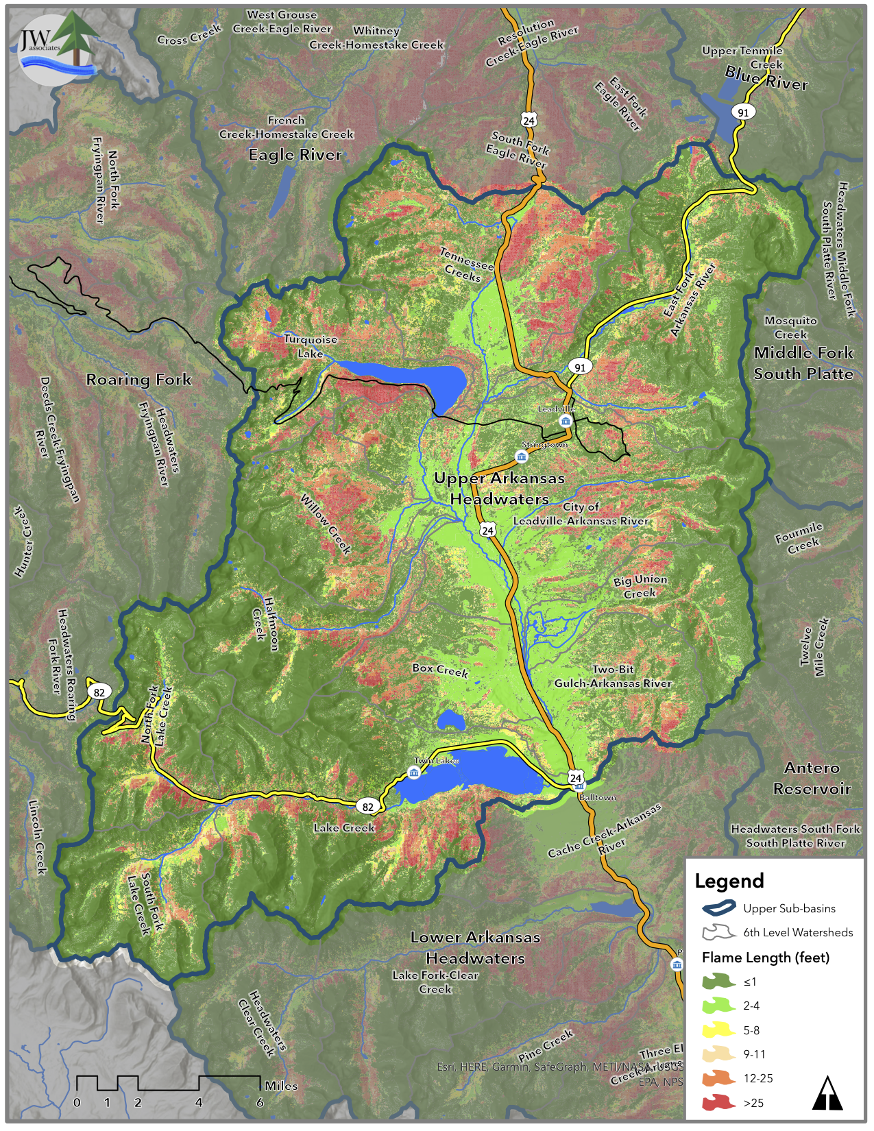
Upper Arkansas Headwaters Sub-Basin


Roaring Fork Sub-Basin